


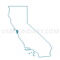
Voting District 40665, San Mateo County, California
About
Outline

Summary
| Unique Area Identifier | 543024 |
| Name | Voting District 40665 |
| County | San Mateo County |
| State | California |
| Area (square miles) | 1.26 |
| Land Area (square miles) | 1.25 |
| Water Area (square miles) | 0.00 |
| % of Land Area | 99.93 |
| % of Water Area | 0.07 |
| Latitude of the Internal Point | 37.46499230 |
| Longtitude of the Internal Point | -122.25238580 |
Maps


Graphs
Select a template below for downloading or customizing gragh for Voting District 40665, San Mateo County, California


Neighbors
Neighoring Voting District (by Name) Neighboring Voting District on the Map
- Voting District 30260, San Mateo County, CA
- Voting District 30265, San Mateo County, CA
- Voting District 30275, San Mateo County, CA
- Voting District 30280, San Mateo County, CA
- Voting District 30285, San Mateo County, CA
- Voting District 30286, San Mateo County, CA
- Voting District 30615, San Mateo County, CA
- Voting District 40645, San Mateo County, CA
- Voting District 40650, San Mateo County, CA
- Voting District 40655, San Mateo County, CA
- Voting District 40690, San Mateo County, CA
- Voting District 40790, San Mateo County, CA
- Voting District 40810, San Mateo County, CA
Top 10 Neighboring County Subdivision (by Population) Neighboring County Subdivision on the Map
Top 10 Neighboring Place (by Population) Neighboring Place on the Map
Top 10 Neighboring Elementary School District (by Population) Neighboring Elementary School District on the Map
Top 10 Neighboring Secondary School District (by Population) Neighboring Secondary School District on the Map
Top 10 Neighboring State Legislative District Lower Chamber (by Population) Neighboring State Legislative District Lower Chamber on the Map
Top 10 Neighboring State Legislative District Upper Chamber (by Population) Neighboring State Legislative District Upper Chamber on the Map
Top 10 Neighboring 111th Congressional District (by Population) Neighboring 111th Congressional District on the Map
Top 10 Neighboring Census Tract (by Population) Neighboring Census Tract on the Map
- Census Tract 6111, San Mateo County, CA (5,913)
- Census Tract 6096.03, San Mateo County, CA (5,318)
- Census Tract 6098, San Mateo County, CA (4,492)
- Census Tract 6097, San Mateo County, CA (4,386)
- Census Tract 6112, San Mateo County, CA (3,005)
- Census Tract 6099, San Mateo County, CA (2,944)
- Census Tract 6133, San Mateo County, CA (2,723)